Vitosha hiking from Sofia: best trails, picnic spots and buses
Hiking Vitosha from Sofia: Golden Bridges, Kumata and Cherni Vrah, Boyana Waterfall, Kopitoto, the best picnic meadows and the buses that get you there.
Sources checked - 8 October 2026
In this article
Vitosha is the mountain at the end of Sofia's boulevards, close enough that a city bus takes you to the trailheads. In 1934 it became the first nature park in the Balkans, and today the park covers about 266 km² of spruce forest, boulder fields and high moorland, topped by Cherni Vrah (Wikipedia). In a single day you can walk from a forest picnic meadow to a summit at 2,290 m, or climb from the edge of the city to an 18 m waterfall, and be back in town for dinner.
What makes Vitosha worth the trip
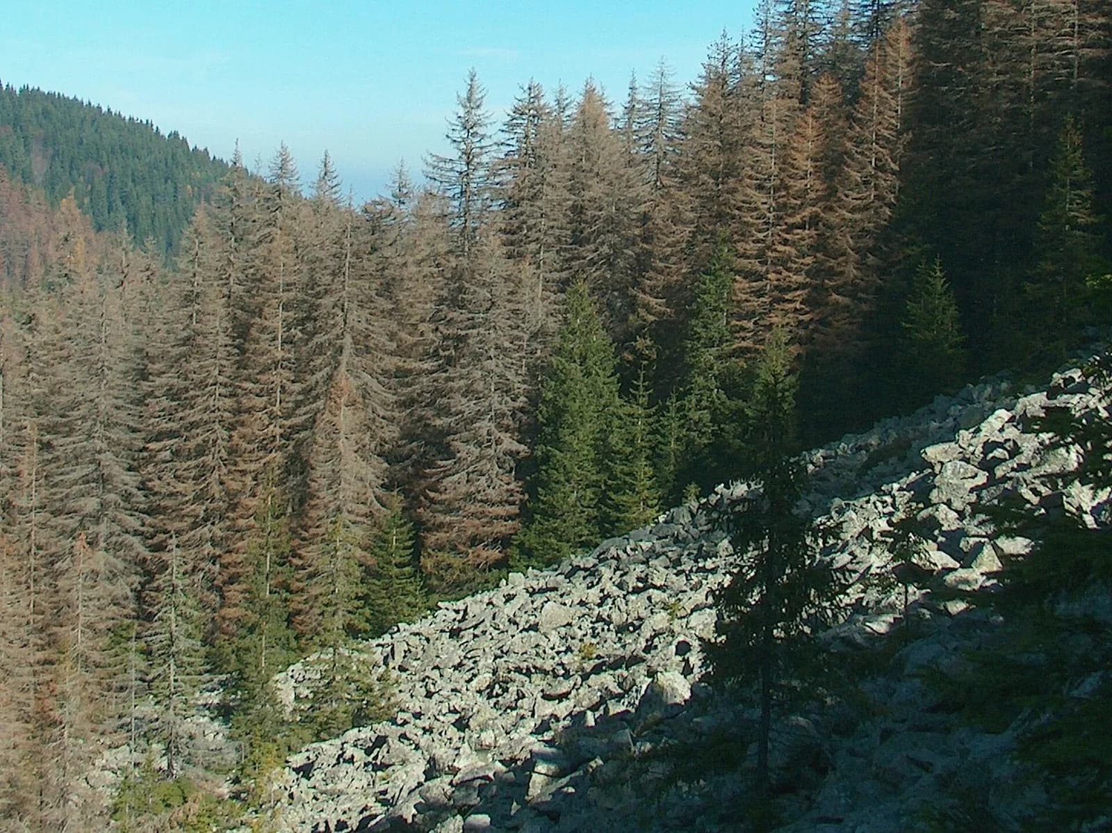
The stone rivers. Vitosha's signature landscape is the stone river: a long ribbon of huge rounded syenite boulders running down the slope through the forest. The best known is Zlatnite Mostove, the Golden Bridges (Wikipedia). It is the starting point for most of the walks below.
Cherni Vrah. The highest summit, at 2,290 m, sits on a broad plateau above the treeline. The standard route from Kumata hut follows a line of numbered metal poles, set closer together near the top because of the deep drifts that form there in winter. A small stone shelter, Sedloto, was built near the summit because the weather on this high ground changes fast in every season (park routes). The upper part of the route runs along the edge of the Torfeno Branishte peat-bog reserve, so stay on the marked line.
Boyana Waterfall. About 4 km above the Boyana quarter, at 1,260 m, the Boyana river drops 18 m over the andesite band that rings the mountain. When the river is high you can see it from Sofia as a silver thread in the middle of the slope. The path up passes Vitosha's only yew grove, where some trees can be more than 500 years old (park routes).
Forest huts and meadows. Between Golden Bridges and the treeline lie meadows and old mountain huts. Kumata hut, at 1,725 m, was begun in 1927 and is a classic base for Cherni Vrah. Vetrovala takes its name from the 1956 whirlwind that flattened the conifer forest there; black pine has been planted in its place. Ofelii, at 1,520 m, is a domed meadow with views across to the cliffs of Chernata Skala (park routes).
The best walks
All times are the park's figures for the outward walk only; add the return and your stops (park routes).
| Route | Time | Climb | Marking | Best for |
|---|---|---|---|---|
| Golden Bridges - Kumata hut | 50 min | 375 m | Blue | A short, steep forest climb past the stone river |
| Golden Bridges - Vetrovala - Ofelii - Kumata hut | 1 h 30 min | 335 m | - | The gentler, shadier way up, with picnic stops |
| Golden Bridges - Bor holiday home | 50 min | 255 m | Yellow | Meadows and pine forest; wet underfoot higher up |
| Kumata hut - Cherni Vrah | 2 h | 566 m | Numbered poles | The summit, above the treeline |
| Golden Bridges - Kopitoto | 50 min | Mostly level | - | The TV-tower summit with the view over Sofia |
| Boyana - Boyana Waterfall - Momina Skala hut | 2 h (waterfall at 1 h 30 min) | 750 m | - | The waterfall and yew grove from the city edge |
| Boyana - Kopitoto - Kamen Del hut | 2 h 10 min | 710 m | - | A sustained climb from town through mixed forest |
| Vladaya - Golden Bridges | 1 h 30 min | 560 m | Blue | Walking up from the train and bus village of Vladaya |
Golden Bridges to Kumata and Cherni Vrah
This is the classic summit day from the city. The blue-marked path leaves Golden Bridges up steep stone steps beside the stone river, crosses a footbridge and climbs through spruce to Kumata hut. From the hut, follow the numbered poles south: past the first level ground at Konyarnika (1,850 m) with its mountain rescue hut and fountain, up beside the ski lift, across the second plateau at Tri Kladentsi and finally up the steep last section past Sedloto shelter to the summit (park routes). About 940 m of climbing in under three hours of walking time up, so plan a full day with the descent.
Through Vetrovala and Ofelii
For a softer half day, take the left bank of the Vladayska from Golden Bridges to the Vetrovala meadow, continue up the road to Ofelii and then take the forest path to Kumata hut. It is the better choice on hot summer days, in the shade of old spruce forest. Return the short way via the blue path, or come back the same way for the picnic stops.
Boyana Waterfall
From the centre of Boyana, the path climbs through mixed forest to the Yanevitsa meadow, then along the Petrovichka valley through the yew grove to a junction at Drenska Skala, where a stony side path leads to the waterfall in about five minutes. You can continue to Momina Skala hut and come down another way. The final side path is stony, so take care when it is wet.
Kopitoto
From Golden Bridges a broad path leads in about 50 minutes to Kopitoto, the rocky summit with the TV tower above Sofia, with little climbing. It is the easiest way to get a big view of the city.
Picnic spots
Vitosha's rest areas are part of the walk rather than a destination in themselves, and the park's route descriptions list what each one has (park routes):
- Vetrovala: a broad meadow ringed by old conifers, 20 minutes from Golden Bridges, with a fireplace, tables, benches, loungers and a stone fountain by the stream. The easiest family picnic.
- Ofelii: a rest area at the northern edge of the meadow with tables, benches, a fireplace and a small fountain set in a tree trunk, plus a bust of the poet Peyo Yavorov on a boulder at the lower end. More open and more views; bring a layer.
- The Bor meadow: on the yellow route towards the Bor holiday home, a sunny south-facing meadow in old pine forest with a solid shelter, fireplace, tables, benches and a children's corner.
- Semovitsa: a low wooded hill just above Boyana, with a rest area, fountain, pond, table and benches on top; a quick escape from the city on the way to Kopitoto.
Do not count on a free table at the popular rest areas. A ready-to-eat picnic is simpler than cooking: use only the built fireplaces at rest areas, never light a new fire, and carry your rubbish back to town if the bins are full. Bring drinking water rather than relying on fountains.
Suggested plans
Half day: bus 63 to Golden Bridges, stone river, Vetrovala and Ofelii, back down the blue path past Kumata. Picnic at Vetrovala.
Full day, summit: Golden Bridges to Kumata hut and Cherni Vrah, returning the same way. Start early; the last bus down leaves in the evening.
From the city edge: Boyana to Boyana Waterfall and Momina Skala hut, then down to Golden Bridges for the bus. For the city's own sights, see the Sofia museums guide.
Getting there by bus
City buses and a tram run right up to the trailheads (park access page):
| Line | From | To | Notes |
|---|---|---|---|
| Bus 63 | Tsar Boris III Blvd at Akad. Ivan Geshov Blvd (stop 2543) | Golden Bridges | Runs every day; last bus down 20:00 from April to October, 17:45 from November to March |
| Bus 66 | Zoo | Hotel Moreni, Aleko | Runs every day; for the high plateau and Cherni Vrah from the east |
| Bus 64 | Zoo or Hygiene Centre | Boyana and Dragalevtsi | For the Boyana Waterfall route |
| Tram 5 | Palace of Justice | Knyazhevo | For the old path up to Golden Bridges |
| Bus 59 | Knyazhevo bus station | Vladaya | For the Vladaya route |
The Dragalevtsi chairlift is out of service. Sofia Municipal Council made bus 63 a year-round line in 2025 (Council Decision 52). Check the day's departures on Sofia Traffic before you set out, especially the return.
Routes and transport were checked on 8 October 2026. Above the treeline, Vitosha behaves like a high mountain: carry a warm layer and waterproof, turn back in fog on the summit plateau, and expect snow and ice from late autumn to spring.
Sources & further reading
- Tourist routes - Vitosha Nature Park - Vitosha Nature Park Directorate
- Access and transport - Vitosha Nature Park - Vitosha Nature Park Directorate
- Decision 52: public transport to Vitosha - Sofia Municipal Council
- Sofia public transport - Sofia Traffic
- Vitosha - Wikipedia
Tags
- Vitosha
- Sofia hiking
- Golden Bridges
- Cherni Vrah
- Boyana Waterfall
- picnic spots
- day trips from Sofia