Climbing Yr Wyddfa (Snowdon): six paths, buses and parking
Compare the six main paths up Yr Wyddfa, Wales's highest mountain, then plan the Sherpa bus, Pen y Pass parking, the railway and the weather for your day.
Sources checked - 8 October 2026
In this article
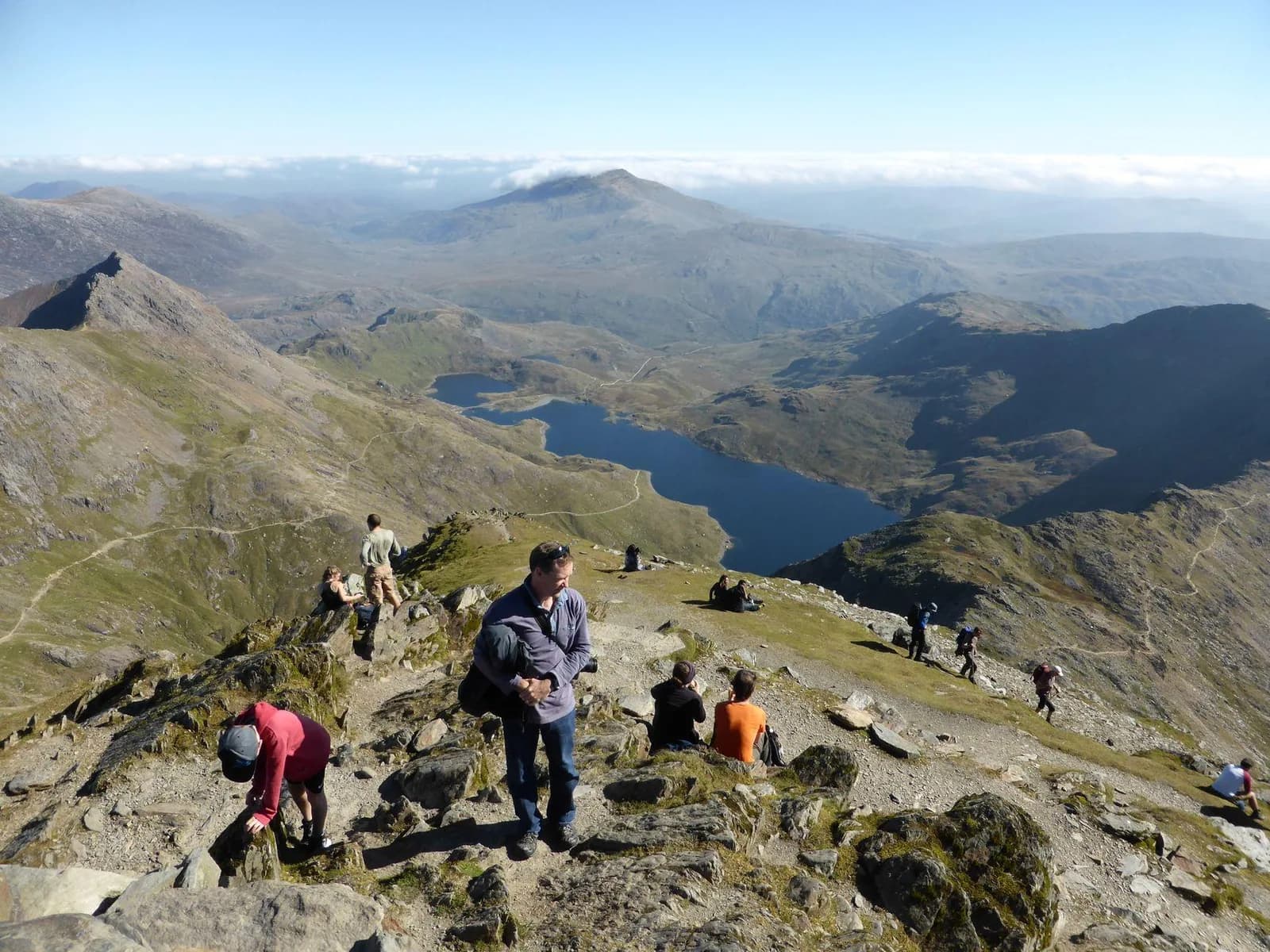
Yr Wyddfa, also known as Snowdon, is the highest mountain in Wales at 1,085 m and the busiest, with more than 600,000 people reaching the summit each year (route-choice guide; Watkin Path). Six main paths climb it, and the Eryri National Park Authority grades every one Hard/Strenuous. For a first ascent by someone fit and used to hillwalking, the Llanberis Path is the most gradual. Pyg and Miners' give the classic lake scenery from Pen y Pass. The western and southern paths are quieter or steeper and reward experience.
The six paths compared
All figures are the park's there-and-back distances and times, up and down the same path.
| Path | Return distance, time | Ascent | Start | In a word |
|---|---|---|---|---|
| Llanberis | 14.5 km, 7 hr | 975 m | Victoria Terrace, Llanberis | Longest, most gradual |
| Pyg | 11 km, 6 hr | 895 m | Pen y Pass | Rugged, gains height early |
| Miners' | 13 km, 6 hr | 723 m | Pen y Pass | Gentle lake approach, steep finish |
| Snowdon Ranger | 13 km, 6 hr | 936 m | Llyn Cwellyn | Quieter western approach |
| Rhyd Ddu | 12 km, 6 hr | - | Rhyd Ddu | Narrow rocky ridge near the top |
| Watkin | 13 km, 6 hr | 1,015 m | Pont Bethania, Nant Gwynant | Biggest climb, loose scree |
Llanberis follows the line of the mountain railway for much of the way. On the way up you look over Cwm Brwynog, where an abandoned farming community of some 25 dwellings and the Hebron chapel survive; Clogwyn station itself is nicknamed the "valley of the hats", after Victorian passengers' hats blown off by the wind. Above it rise the cliffs of Clogwyn Du'r Arddu, famous with climbers. Keep to the path and clear of the tracks (Llanberis Path).
Pyg and Miners' both start at Pen y Pass and merge high on the mountain, so you can go up one and down the other. The Pyg Track climbs quickly over rocky ground to Bwlch y Moch, where Llyn Llydaw and its causeway come into view. There the path to Crib Goch branches off: a knife-edge scrambling ridge with no escape route that the park says novices should not attempt. Stay on the Pyg (Pyg Track). The Miners' Track was built for the Britannia Copper Mine and passes Llyn Teyrn, crosses Llyn Llydaw on an 1853 causeway, and reaches Glaslyn beneath the summit, past the ruins of the mine's crushing mill. Save energy: the final climb from Glaslyn is steep (Miners' Track).
Snowdon Ranger climbs gradually from the shore of Llyn Cwellyn over the slopes of Moel Cynghorion to Bwlch Cwm Brwynog, then steeply above Clogwyn Du'r Arddu to join the Llanberis Path. Rhyd Ddu starts in the village of the same name on an old slate quarry track, climbs the rocky Llechog ridge and follows the narrow ridge of Bwlch Main, with steep slopes below, where wind and visibility matter (Snowdon Ranger; Rhyd Ddu). Rhyd Ddu's 60-space car park can fill by 8:00 on busy spring and summer days.
Watkin has the greatest ascent, from near sea level at Nant Gwynant. It passes old slate quarry workings and Gladstone Rock, where Prime Minister William Gladstone addressed more than 2,000 people at the path's opening in 1892, then crosses loose scree before joining the Rhyd Ddu Path near the top. The park suggests first-timers consider another route (Watkin Path).
Getting there: the Sherpa bus
The Sherpa'r Wyddfa bus network circles the mountain and stops close to all six starts, which makes it easy to climb one path and descend another. A day ticket costs £7.50 for an adult, £5 for concessionary and young people's travel-pass holders, and £16 for a family of up to two adults and three children, and it covers all buses in North Wales for the day (Sherpa'r Wyddfa).
| Start | Bus | From |
|---|---|---|
| Llanberis Path | S1, S2 | Caernarfon about 25 min, Betws-y-Coed about 40 min, Bangor about 50 min |
| Pen y Pass (Pyg, Miners') | S1, S2, S5 | Nant Peris about 15 min, Llanberis about 20 min; S1 from Betws-y-Coed about 20 min |
| Snowdon Ranger, Rhyd Ddu | S3 | Caernarfon about 20 to 25 min |
| Pont Bethania (Watkin) | S4 | Porthmadog about 35 min |
Journey times are from the park's transport guide; check the current timetables for your date.
Parking at Pen y Pass
Pen y Pass car park is pre-book only until 1 November 2026. Charges are £25 for up to 8 hours, £35 for 8 to 12 hours and £45 for a full day, and bookings cannot be extended, so allow for a six-hour walk plus stops (Pen y Pass car park). The simpler option is to park at Nant Peris, Llanberis or Caernarfon and take the Sherpa up. Parking at Nant Gwynant for the Watkin Path is very limited and often full by 7:30 (getting to Yr Wyddfa).
The mountain railway
The Snowdon Mountain Railway runs from Llanberis. In autumn 2026 essential works mean that selected services stop at Clogwyn rather than the summit: Clogwyn from 5 to 16 October, the summit from 17 to 25 October, and Clogwyn again from 26 October until the season's last diesel service on 1 November. The summit visitor centre, Hafod Eryri, opens from 10:00 daily between 1 May and 25 October, weather permitting. Downhill single tickets are sold only at the summit, first come, first served, and cannot be booked, so plan to walk down even if you hope to ride (railway visitor information).
On the day
Check the Met Office mountain forecast and the Yr Wyddfa live conditions page for wind, visibility, snow and ice. Carry waterproofs, warm layers, food, water, a headtorch and a map and compass, and know how to use them. Eryri's free Yr Wyddfa Walks app has offline GPS maps with contours for all six routes. In winter conditions the mountain needs winter skills and equipment.
Turn back if you are slower than planned or the weather turns; the summit will still be there. In an emergency, dial 999 or 112, ask for the Police, then Mountain Rescue, and give your location (Mountain Rescue England and Wales). Information was checked on 8 October 2026.
Sources & further reading
- Choosing the right path on Yr Wyddfa - Eryri National Park Authority
- Llanberis Path route page - Eryri National Park Authority
- Pyg Track route page - Eryri National Park Authority
- Miners’ Track route page - Eryri National Park Authority
- Snowdon Ranger route page - Eryri National Park Authority
- Rhyd Ddu Path route page - Eryri National Park Authority
- Watkin Path route page - Eryri National Park Authority
- Getting to Yr Wyddfa - Eryri National Park Authority
- Pen y Pass car park information - Eryri National Park Authority
- Sherpa’r Wyddfa bus network and fares - Cyngor Gwynedd
- Sherpa’r Wyddfa current timetables - Cyngor Gwynedd
- Yr Wyddfa live conditions - Partneriaeth Yr Wyddfa
- Eryri mountain forecast - Met Office
- Snowdon Mountain Railway visitor information - Snowdon Mountain Railway
- Yr Wyddfa Walks offline navigation app - Eryri National Park Authority
- Calling mountain rescue - Mountain Rescue England and Wales
Tags
- Yr Wyddfa
- Snowdon
- Eryri
- Welsh mountain routes
- Sherpa bus
- Pen y Pass