Central Balkan waterfalls: Raysko Praskalo, Vidimsko Praskalo
Hike to the great waterfalls of Central Balkan National Park: Raysko Praskalo via Rai hut, Vidimsko Praskalo from Apriltsi, and the Byala Reka gorge.
Sources checked - 8 October 2026
In this article
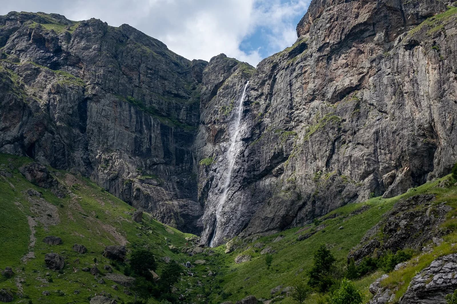
The highest part of the Balkan range, protected as Central Balkan National Park, hides two of Bulgaria's great waterfalls in its wildest corners. Raysko Praskalo drops 124.5 m from just below Botev, the range's highest peak, into the cliffs of the Dzhendema reserve above Kalofer. Vidimsko Praskalo falls about 80 m into a beech-forested gorge above Apriltsi on the northern side (Dzhendema reserve; Vidimsko Praskalo trail). Neither is a roadside stop: each is a proper day's walk, and that is exactly their appeal.
Raysko Praskalo and Rai hut
The waterfall and the reserve
Raysko Praskalo, roughly "the Paradise Spray", is one of the highest waterfalls in Bulgaria. It pours off the southern slopes almost from the summit of Botev, which locals call Yumrukchal, beside the Rai hut and the cliffs known as the Paradise Rocks. The setting is the Dzhendema reserve, declared in 1953 and covering 4,227.8 ha, the largest reserve in the park and a UNESCO biosphere reserve. Its name comes from the Turkish word for hell, a nod to the steep canyons, sheer drops and rock walls of the upper Byala Reka and Tundzha valleys. The forests are mostly beech and mixed woodland 100 to 150 years old, and the cliffs are home to red deer, chamois and large birds of prey, including golden and eastern imperial eagles (Dzhendema reserve).
Walking to Rai hut
The standard approach is from Kalofer via the Panitsite area to Rai hut, about 4 hours 30 minutes on foot. The hut stands at 1,560 m on the southern side of Botev, with the waterfall falling behind it (Rai hut). It is a sustained climb into the high mountains rather than a gentle waterfall walk, and returning to Kalofer the same day makes for a long outing.
Most of the pleasure is in staying the night. Rai hut is a three-storey building with 120 places, run by the Haidut tourist society of Kalofer, with hydroelectric power and a kitchen. From the hut it is about 2 hours 30 minutes on to Botev summit, and there are connections to Vasil Levski hut (4 hours 30 minutes), Tazha hut (3 hours) and Pleven hut (5 hours 30 minutes) (Rai hut). A two-day plan, Kalofer to Rai hut on the first day and Botev with a descent on the second, shows off the whole southern face of the range.
Vidimsko Praskalo above Apriltsi
The waterfall and the gorge
Vidimsko Praskalo falls from rock walls into the Northern Dzhendem reserve on the north side of the range. The eco-trail to it starts from the Vidima hydroelectric power plant in the Vidima quarter of Apriltsi and follows the Praskalska river upstream through old beech forest, crossing it on five wooden bridges. Two viewing platforms end the route: the first looks down to the river, the second gives a panorama across Northern Dzhendem towards the waterfall and marks the end of the trail (Vidimsko Praskalo trail).
Walking the eco-trail
The park rates the trail easy, but the round trip is about 12 km and takes around 6 hours, so treat it as a full day with a packed lunch. The route passes through a reserve, where leaving the marked trail and its facilities is prohibited and fined, and the park does not recommend it in winter (Vidimsko Praskalo trail). The trail ends at a viewpoint facing the waterfall rather than at its foot.
Byala Reka gorge above Kalofer
The Byala Reka interpretative trail runs up the gorge of the Byala Reka river above Kalofer Monastery, at the start of the Dzhendema reserve, with bridges and stairs built along the narrow sections; the park gives it 2 hours 30 minutes (Byala Reka trail). It opened in 2004 about 6 km from Kalofer and was fully renovated in 2023 (renovation notice).
It is currently closed. A park order of 30 December 2025 bans tourist passage, stays and use of the infrastructure at the Byala Reka visitor complex, as well as driving and parking on its access road, until construction work there is finished (closure notice). No reopening had been announced by 8 October 2026.
How to choose
| Option | Raysko Praskalo | Vidimsko Praskalo | Byala Reka |
|---|---|---|---|
| Start | Kalofer | Vidima quarter, Apriltsi | Above Kalofer Monastery |
| Walking time | About 4 h 30 min up to Rai hut | About 6 h round trip, 12 km | 2 h 30 min |
| Character | Steep climb into the high mountains | Long, easy forest trail to viewpoints | Short gorge trail with bridges and stairs |
| Best as | Overnight at Rai hut, maybe with Botev | A full day trip | A short walk, once it reopens |
| Status on 8 October 2026 | Open | Open, not recommended in winter | Closed for construction |
Sources: Rai hut, Vidimsko Praskalo trail, Byala Reka trail.
Kalofer and Apriltsi lie on opposite sides of the range, so the two big waterfalls belong to different trips. Kalofer pairs naturally with Karlovo and the Rose Valley (see the Karlovo, Kalofer and Sopot guide); Apriltsi is reached from the Troyan side (see the Lovech, Troyan and Pleven guide).
Park rules
Stay on the marked routes, which is compulsory inside reserves such as Dzhendema and Northern Dzhendem. Camp and light fires only at designated places, keep dogs on a lead, do not pick flowers, and do not enter the rivers and pools. Driving on park roads is restricted and needs permission. Fines run from 500 to 5,000 leva for individuals (visitor information). The park website publishes current closures; check it before you go, along with the mountain forecast.
Sources & further reading
- Dzhendema Reserve - Central Balkan National Park - Central Balkan National Park Directorate
- Hut Rai - Central Balkan National Park Directorate
- Vidimsko Praskalo eco-trail - Central Balkan National Park Directorate
- Interpretative Trail of Byala Reka River - Central Balkan National Park Directorate
- The completely renovated Byala Reka eco-trail is open for visitors - Central Balkan National Park Directorate
- The ban on visits and bivouacs at the Byala Reka campsite is extended - Central Balkan National Park Directorate
- Central Balkan National Park visitor information - Central Balkan National Park Directorate
Tags
- Central Balkan
- waterfalls
- Raysko Praskalo
- Vidimsko Praskalo
- Kalofer
- Apriltsi
- Stara Planina