In this article
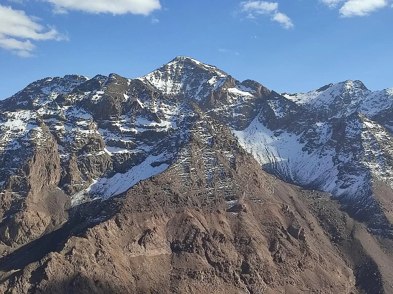
At 4,167 m, Jebel Toubkal is the highest peak in Morocco, the Atlas Mountains and all of North Africa (Wikipedia). It rises at the centre of Toubkal National Park, created in 1942 in the High Atlas south of Marrakech (Wikipedia). In summer the normal route is a non-technical walk that puts a 4,000 m summit within reach of fit hillwalkers, but the altitude, the length of summit day and winter snow make it a real mountain.
Most people climb it in two days from the village of Imlil, sleeping at one of the stone refuges at about 3,200 m. Adding a third day makes the descent far kinder.
The route from Imlil
The regional tourism board's route card describes the classic two-day ascent (route card).
Day 1: Imlil (1,700 m) to the refuge (3,210 m). About 10 km and 1,520 m of ascent, roughly five hours of walking. The path climbs to the village of Aremd, with its terraced fields and irrigation channels under the cliffs of Aksoual, then follows the valley of the Assif n'Aït Mizane past Sidi Chamharouch. The valley is dominated by the truncated pyramid of Agoujdad n'Tichki (3,627 m). As the refuges come into view, the glacier-carved peaks of the upper valley appear, among them Akioud (4,030 m) and Ras n'Ouanoukrim (4,083 m).
Day 2: summit (4,167 m) and descent to Imlil. About 16 km with 970 m of ascent and 2,480 m of descent, around eight and a quarter hours. You cross the stream just above the refuge, climb scree to around 3,600 m, then enter the upper valley of Ikhibi Sud, which is closed off by Toubkal itself. The pass of Tizi n'Toubkal, a flat spot at 3,970 m, is reached about two and a half hours after leaving the refuge, and the summit, marked by its survey beacon, roughly 45 minutes later. The route card calls the final climb steep and sometimes awkward, and warns that the Ikhibi Sud route is very busy. From the top, the panorama stretches across the High Atlas.
Those times are averages for a fit walker. Leave plenty of margin for your group's pace, photo stops and conditions underfoot.
Two days or three?
| Plan | Walking days | Trade-off |
|---|---|---|
| Two days | Imlil to refuge; refuge to summit to Imlil | One refuge night, but a very long second day with 2,480 m of descent |
| Three days | Imlil to refuge; refuge to summit and back to refuge; refuge to Imlil | A second refuge night and a relaxed summit morning |
| Longer, staged trek | Extra nights at lower altitude before the refuge | Better acclimatisation, more time in the valleys |
The third day changes the experience. You can start the summit in the dark, enjoy the top and come back to a meal and a bed instead of facing nearly 2,500 m of knee-jarring descent in one go.
Altitude and acclimatisation
The jump from Imlil to the refuge raises your sleeping altitude by about 1,500 m in a single day. The CDC advises against going from low altitude straight to a sleeping height above 2,750 m in one day, and above 3,000 m it suggests raising your sleeping altitude by no more than 500 m a day (CDC). The standard itinerary breaks that guideline, so build in time where you can: a night or two around Imlil with a day walk higher up, or a longer trek that sleeps at intermediate heights before the refuge. Fitness does not protect against altitude illness.
Headache together with nausea, dizziness or unusual tiredness after arriving at the refuge can mean acute mountain sickness. Rest and do not go higher until mild symptoms clear; if they get worse, go down. Confusion, stumbling or breathlessness at rest are emergencies that call for immediate descent and medical help.
Refuges and prices
There are two refuges side by side at the head of the valley, and they are separate businesses, so book by name.
- Refuge du Toubkal, run by the Club Alpin Français of Casablanca, is a stone building in traditional Berber style, built in 1999 (CAF refuges).
- Refuge Les Mouflons, a private refuge at 3,207 m, is open all year, with dormitories as well as single and family rooms with separate showers (Les Mouflons).
The CAF's published rates for non-members are 250 MAD a night in summer (1 May to 31 October 2026) and 300 MAD in winter (1 November 2025 to 30 April 2026). Breakfast costs 50 MAD, lunch and dinner 100 MAD each, and a hot shower 10 MAD. Alpine club members pay less on showing their membership card (CAF rates). Rates for winter 2026/27 had not been published at the time of checking, so ask when you book.
Guides, seasons and safety
Go with a licensed mountain guide. The UK government's travel advice for the Atlas tells hikers to research the route and the experience it needs, pack water, sun protection and suitable clothing, hire a professional guide and make sure their insurance covers the activity (FCDO). Agree the plan for summit day with your guide in advance, including the turnaround time and how far you will descend.
Summer, from around May, is the easiest time to climb. In winter and early spring the route is under snow and ice and becomes a mountaineering ascent that needs crampons and an ice axe and the skills to use them (Wikipedia). The FCDO also warns of flash floods in the mountains in winter; check the national weather vigilance map before you go.
The Al Haouz earthquake of September 2023 hit the villages of this part of the High Atlas hard. Climbers were returning to Toubkal by the end of that year (Hespress).
Practical details
| Item | Detail |
|---|---|
| Start | Imlil, 1,700 m |
| Refuges | Refuge du Toubkal (CAF) and Refuge Les Mouflons, about 3,200 m |
| Day 1 | 10 km, +1,520 m, about 5 hours |
| Summit day | 16 km, +970 m and -2,480 m to Imlil, about 8 hours 15 minutes |
| CAF non-member rates | 250 MAD a night (summer 2026), 300 MAD (winter 2025/26); dinner 100 MAD, breakfast 50 MAD |
| Bring | Warm and waterproof layers, headlamp, sun protection, water and snacks; crampons and ice axe when there is snow |
Refuge rates and travel advice were checked on 8 October 2026.
Sources & further reading
- Destination Montagne Drive (Toubkal ascent from Imlil) - Conseil Régional du Tourisme Marrakech-Safi
- Club-managed refuges - Club Alpin Français de Casablanca
- Toubkal refuge rates 2025/2026 - Club Alpin Français de Casablanca
- Refuge Les Mouflons - Refuge Les Mouflons
- Toubkal - Wikipedia
- Toubkal National Park - Wikipedia
- High-altitude travel and altitude illness - US Centers for Disease Control and Prevention
- Morocco travel advice, safety and security - UK Foreign, Commonwealth & Development Office
- Climbers return to Mount Toubkal as region recovers from Al Haouz quake - Hespress
- Morocco meteorological vigilance map - Direction Générale de la Météorologie du Maroc
Tags
- Mount Toubkal
- Imlil
- Toubkal Refuge
- High Atlas
- Morocco