Uluṟu and Kata Tjuṯa: which walks to do and when
Choose between the Uluṟu base walk, Mala and Kuniya, Valley of the Winds and Waḻpa Gorge, with the 36°C heat closure, park passes and cultural guidelines.
Sources checked - 8 October 2026
In this article
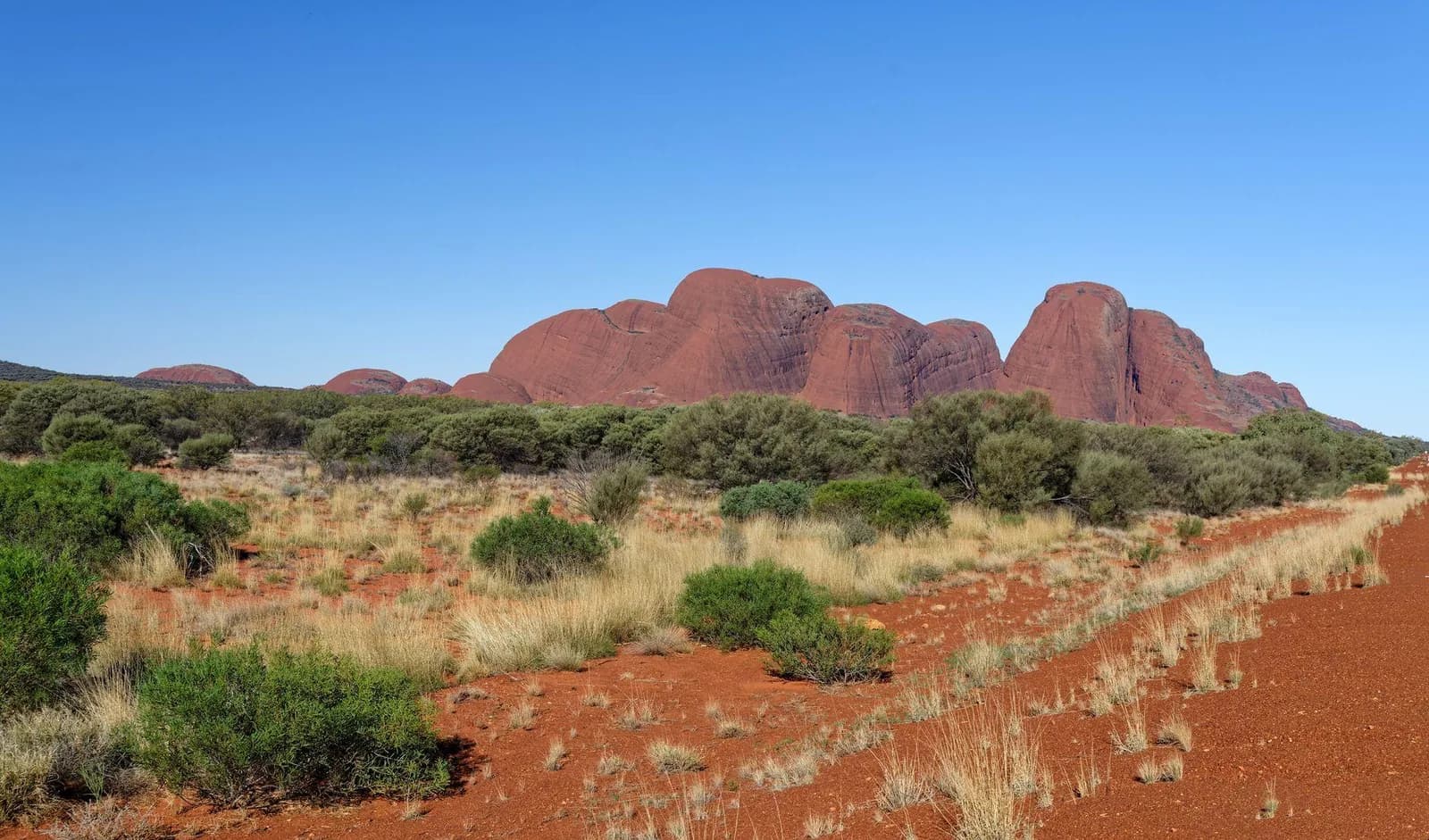
Uluṟu rises 348 m above the red plains of central Australia, a single mass of rock 9.4 km around its base. Nearby, the domes of Kata Tjuṯa climb even higher, the tallest standing 546 m above the plain (Parks Australia). Both are sacred to Aṉangu, the traditional owners, whose connection to this country goes back some 30,000 years. The title was handed back to them on 26 October 1985, and the park, a World Heritage Site for its nature since 1987 and as a living cultural landscape since 1994, is run jointly by Aṉangu and Parks Australia (park history).
The best way to understand both places is on foot. The climb up Uluṟu closed permanently on 26 October 2019 (climb closure); the walks go around and among the rocks instead.
Walks at Uluṟu
The base walk circles the whole rock: 10.6 km, about 3.5 hours, grade 3 (base walk). It is the walk that shows how much variety a single rock holds. Some sections are surprisingly green, with acacia woodland, bloodwoods, native grasses, creeks and waterholes; others are open and wide. Start early at Mala carpark and walk clockwise. There are water stations, toilets and emergency call points along the way. You can hire a bike to ride it instead.
Mala walk: 2 km return, about 1.5 hours, grade 2. It follows part of the base of Uluṟu past places linked to the Mala story, a kitchen cave and rock art, ending at Kaṉtju Gorge (Mala walk).
Kuniya walk: 1 km return, 30 to 45 minutes, grade 2. A short, leafy path to Muṯitjulu Waterhole, through a landscape tied to the story of Kuniya and Liru (Kuniya walk).
If you have time for only one thing, do the base walk in the morning. If you have an hour, Kuniya and Mala together give a strong sense of the rock's stories.
Liṟu walk closure. Since 1 April 2026 the Liṟu walk, which links the Cultural Centre to the base walk, has been closed after flood damage. A temporary track follows the old road past Pulaṟi, a sacred site where photography is not allowed, to join the Lungkaṯa walk towards Mala carpark or Kuniya. Bike hire has moved to Mala carpark for now (closure notice).
Walks at Kata Tjuṯa
Valley of the Winds is the big walk at Kata Tjuṯa: a 7.4 km loop of three to four hours, grade 4, that drops into valleys and creek beds between the domes (Valley of the Winds). You can stop sooner:
| Option | Distance | Time | Notes |
|---|---|---|---|
| Karu Lookout | 2.2 km return | About 1 hour | Moderately difficult, with loose rock |
| Karingaṉa Lookout | 5.4 km return | About 2.5 hours | Challenging, with many steps and steep sections |
| Full circuit | 7.4 km loop | 3 to 4 hours | Grade 4; steep, rocky in places |
The park says that once you reach Karingaṉa, completing the loop is easier than turning back. There is water at the start and halfway, but no toilets on the track.
Waḻpa Gorge is the shorter alternative: 2.6 km return, about an hour, grade 3, up a rocky path into the gorge, past rare plants and a seasonal stream to a grove of spearwood at the end (Waḻpa Gorge).
Heat: the rule that shapes the day
When the forecast or actual temperature reaches 36°C, Valley of the Winds closes at Karu Lookout from 11 am (Valley of the Winds). Summer temperatures regularly pass 30°C and can top 40°C, so the park asks walkers not to walk after 11 am in hot weather and to carry and drink at least one litre of water per person per hour (staying safe).
In practice that means starting long walks at first light from late spring to early autumn. Watch for thirst, cramps, dizziness, nausea or confusion, rest in shade if anyone feels unwell, and call 000 or 112 in an emergency. Also give king brown snakes and dingoes a wide berth.
Photos and respect
Aṉangu ask visitors not to photograph the rock formations along Valley of the Winds; these places hold knowledge that should be learned in person from those with the authority to share it. Photos of plants, animals and people are fine. At Waḻpa Gorge, keep both walls of the gorge in any photo. At Uluṟu, respect the signed no-photo areas, and ask before photographing people (photography).
A three-day plan
The standard park pass lasts three days, which suits this rhythm well:
- Day 1: Arrive in the afternoon, visit the Cultural Centre (open 07:00 to 17:45), then watch the sunset at Uluṟu.
- Day 2: Base walk at first light, Kuniya walk afterwards if you still have energy.
- Day 3: Valley of the Winds at dawn, then Waḻpa Gorge on the way out if it is not too hot.
Getting there and practical details
Ayers Rock Resort at Yulara is the base for visits. From there it is about 20 minutes by road to Uluṟu and 45 minutes to Kata Tjuṯa, so plan the two on separate mornings (getting around).
| Item | Detail |
|---|---|
| Park pass | AUD 38 per adult for three days; AUD 50 annual; under 18s free |
| Where to buy | Online or at the park entry station |
| Park hours | Open every day; closes at night, with times changing month by month |
| Cultural Centre | 07:00 to 17:45 daily |
| Heat closure | Valley of the Winds closes beyond Karu Lookout from 11 am at 36°C or more |
| Emergency | 000 or 112 |
Passes and hours are on the park's pass and opening-hours pages. Prices, closures and walk details were checked on 8 October 2026; check the monthly gate times so you leave the park before it closes.
Sources & further reading
- Amazing facts - Parks Australia
- History of Uluṟu-Kata Tjuṯa National Park - Parks Australia
- Uluṟu climb closure - Parks Australia
- Uluṟu base walk - Parks Australia
- Mala walk - Parks Australia
- Kuniya walk and Muṯitjulu Waterhole - Parks Australia
- Valley of the Winds walks - Parks Australia
- Waḻpa Gorge walk - Parks Australia
- Liṟu walk closure and alternative Uluṟu base walk access - Parks Australia
- Staying safe - Parks Australia
- Photography - Parks Australia
- Getting around - Parks Australia
- Buy your park pass - Parks Australia
- Opening hours - Parks Australia
Tags
- Uluṟu
- Kata Tjuṯa
- Valley of the Winds
- Uluṟu base walk
- Australia