Kom-Emine trail: stages, huts, water and organised traverses
Plan the Kom-Emine ridge walk across Stara Planina: why lengths differ, a 20-day stage plan, huts, water, park fire ban, shorter sections and group traverses.
Sources checked - 27 October 2026
In this article
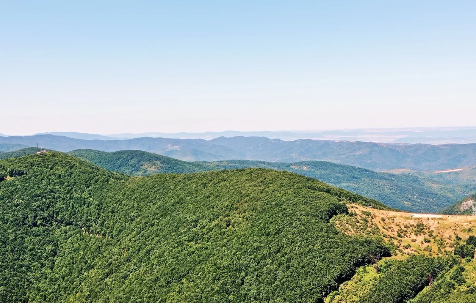
Kom-Emine is the walk along the main ridge of the Balkan range, Stara Planina, from Kom peak (2,016 m) above Berkovitsa near the Serbian border to Cape Emine on the Black Sea. It is Bulgaria's longest marked hiking route and the Bulgarian section of the European long-distance path E3 (Eho guide, 2016). Most walkers take about 20 days; well-prepared hikers manage it in 15 or 16 (kom-emine.bg). Organised groups walk it every July, sleeping in huts, shelters and village guesthouses and walking 6 to 12 hours a day. The high middle section crosses Central Balkan National Park, where a total ban on open fires has been in force since 13 July 2026.
The route at a glance
| Start | Kom peak, 2,016 m, reached from Kom hut above Berkovitsa |
| Finish | Cape Emine, the eastern tip of the range, about 14 km south of Obzor (Wikipedia) |
| Distance | About 560 to over 700 km, depending on the line taken (see below) |
| Highest point | Botev, 2,376 m (kom-emine.bg) |
| Typical time | 18 to 25 days at a normal pace, around 180 walking hours in all (Eho guide) |
| Waymarking | Red band between two white stripes; yellow and black poles on winter routes |
| Season | July to September; the eastern part can be hot (BulGuides) |
Until 2025 Kom-Emine was the final stretch of E3. In May 2025 Radio Bulgaria reported that the board of the European Ramblers' Association (ERA) had approved an extension along the Black Sea Route from Kom-Emine to Durankulak and Rezovo, so E3 no longer ends at Emine (BNR).
Why the distance figures disagree
You will see anything from 560 to 720 km quoted, and no single figure is wrong. There is no one fixed line: the ridge has alternative paths, summits that can be climbed or skirted, and detours to huts and villages, so the Oilaripi association's route site puts the walk at between 599 and over 700 km (kom-emine.bg). The Bulgarian Tourist Union's newspaper guide calls it "nearly 650 km" (Eho guide). Filtered GPS tracks from walkers and cyclists, cited by Bulgarian Wikipedia, give 560 to 580 km with about 20,500 m of ascent (Wikipedia). At the high end, BulGuides gives 720 km for "the Bulgarian part of E3" (BulGuides), and Radio Bulgaria rounds it to 600 km (BNR).
For planning, the daily hours matter more than the total. The days are long, and kilometres on a ridge with constant climbs say little about how tired you will be.
Waymarking: red and white are the same mark
Descriptions that call the route "red" and those that call it "white-red-white" describe the same paint. Bulgarian summer marking is a band of three stripes: the middle stripe carries the route's colour and a white stripe on each side makes it stand out. Kom-Emine's colour is red; some old marks use yellow instead of white for the outer stripes. Winter routes are marked with metal poles painted in yellow and black bands, often with distance and bearing plates (kom-emine.bg).
Two other marks look similar but are not trail marks. Two stripes, one white and one red, with letters such as НП, mark the boundary of a protected area. White and black stripes mark forestry compartments (kom-emine.bg). The Bulgarian Tourist Union listed refreshing the E3 marking in Stara Planina in its 2026 programme, together with the national and nature parks (BTS calendar).
A 20-day stage plan
This is the plan that the Novi Horizonti club of the Rodni Balkani tourist society, Varna, published for its 2022 traverse, with the organiser's approximate walking hours (BTS, 2022). It shows what an organised group aimed for, not what you should expect to manage. The group set off from Sofia Central Station at 07:00 on the first day, with transport to Kom hut. A support vehicle carried luggage, so the hours assume a light pack and a fast pace. The organisers warned that the days suit only participants in very good physical shape.
| Day | Section | Hours | Notes |
|---|---|---|---|
| 1 | Kom hut - Kom peak - Petrohan pass | 6 | Book a bed first: in 2021 Petrohan hut was not taking guests and the relay slept at the Petrohan creative house, which the route site's 2022 list shows as not working |
| 2 | Petrohan pass - Lakatnik station | 9 | Over Todorini Kukli; Lakatnik is on the Sofia railway |
| 3 | Lakatnik - Leskova hut | 10 | |
| 4 | Leskova hut - Vitinya | 12 | Vitinya pass has a tourist sleeping room |
| 5 | Vitinya - Kashana hut | 11 | Kashana is at the Zlatitsa pass |
| 6 | Kashana hut - Momina Polyana hut | 8 | |
| 7 | Momina Polyana - Eho hut | 11 | Past Vezhen, 2,198 m |
| 8 | Eho hut - Dermenka hut | 8 | Crosses the Troyan pass (Beklemeto) |
| 9 | Dermenka hut - Botev shelter | 11 | Near Botev, the highest point of the route |
| 10 | Botev shelter - Partizanska Pesen hut | 10 | |
| 11 | Partizanska Pesen - Buzludzha hut | 7 | Crosses the Shipka pass |
| 12 | Buzludzha - Predela pass | 11 | |
| 13 | Predela - Chumerna hut | 11 | Shown as not working on the route site's 2022 list, though the 2021 relay group was welcomed there; check |
| 14 | Chumerna - Vratnik pass | 8 | |
| 15 | Vratnik pass - Kotel | 8 | Town with shops and lodging |
| 16 | Kotel - Varbishki pass | 8 | Varbishki Prohod hut |
| 17 | Varbishki pass - Rishki pass | 12 | |
| 18 | Rishki pass - Daskotna village | 9 | |
| 19 | Daskotna - Kozichino village | 12 | |
| 20 | Kozichino - Cape Emine | 12 | The Kozichino hut page gives 8 to 9 hours |
Hut notes come from the 2021 relay report (BTS, 2021), the route site's hut list (kom-emine.bg) and the Kozichino hut page (BTS); Todorini Kukli is on the day-2 line in the Eho guide (Eho guide). Pass names come from the route site's table of passes (kom-emine.bg).
The route site's own 21-day sample, for "moderately fit" walkers, starts in Berkovitsa and runs daily stages of 14 to 44 km; the longest, 44 km, is in the east, from Hazim Gorski's shelter near the Rishki pass to Topchiysko hut (kom-emine.bg). It uses different overnight stops, including Probojnitsa, Trastena, Chavdar, Dobrila and Mazalat huts, which shows how much room there is to shape your own plan.
Where to sleep
Huts are fairly evenly spaced along the ridge, but not all of them are staffed all the time. Some have a keeper only at weekends, and at some you get food only if you order it in advance (Wikipedia). The route site keeps a list of huts, shelters and guesthouses with phone numbers and a "working" or "not working" flag, but that page was last edited in December 2022 (kom-emine.bg). Its advice holds: phone ahead to say you are coming, order meals in advance, and do not count on a free bed or food without a booking.
Hut status must be confirmed before you go. None of the Bulgarian Tourist Union's hut pages for the route shows a live open or closed status. Reports also go out of date: in 2021 the relay walkers found Planinski Izvori hut abandoned and Topchiysko hut in poor condition, with the ceiling of the upper floor fallen in (BTS, 2021). The BTS Information Centre in Sofia, open on weekdays from 09:00 to 17:00, gives free information on the huts and hotels the union runs (BTS Information Centre).
Carry a tent even if you plan to use huts. The 2022 organised group, with 16 nights booked in huts, shelters and guesthouses, still required everyone to bring a tent, mat and sleeping bag (BTS, 2022). Some shelters can be used with just a sleeping bag, and in bad weather the railway stations at Lakatnik and Krastets can serve as a place to spend the night (Wikipedia). Inside the national park, camping is restricted; see the park rules below.
Water
Water, more than anything else, decides where you can stop, especially if you camp. The route site lists water points for the western, central and eastern sections, each tagged "has water", "dries up" or "no water" with the date of its last update (kom-emine.bg). In the eastern list, 18 of the 65 points are tagged "dries up", and village fountains and shops in Kotel, Daskotna, Dobra Polyana and Kozichino are included. Almost all the updates date from 2023, so treat the list as places to look, not a promise.
In July 2023, a Plovdiv group walking from Shipka to Emine in heat of around 40 degrees found many of the fountains dry and carried 2 to 3 litres each, filling up wherever they found water (BTS, 2023). On the ridge, huts get water with difficulty, so do not waste it (kom-emine.bg). No official source lists water for the whole route, so ask the hut keepers each evening about the next day's springs.
Central Balkan National Park rules
The park stretches about 85 km from west to east across the highest part of the range, including Botev (Wikipedia). The park directorate's rules for visitors (park rules):
- Camping: bivouac only at designated places, and respect the number of tents allowed at each. No new shelters, structures or fireplaces. The directorate does not publish a list of these places online; ask at the nearest hut or park office. For the law behind this, and camping rules outside the park, see wild camping in Bulgaria.
- Marked trails: leaving the marked routes inside the park's reserves is prohibited.
- Groups: mass events need the directorate's permission.
- Plants and wildlife: do not pick flowers or break branches; berries, mushrooms and herbs only in permitted places and quantities. Do not disturb wildlife.
- Bicycles and horses: only where the management plan allows.
Fire ban. Order RD-148, dated 14 July 2026 and in effect from 13 July, bans lighting open fires "in any form" anywhere in the park, including the official fireplaces at rest areas (park notice; order). The order gives no end date, and the park's list of notices showed no order lifting it on 27 October 2026 (park notices). In September the park fought a wildfire above the village of Anton, reported under control around its edges on 10 September (park notices). Check the notices again before you go. The order does not mention camping stoves either way; ask the directorate before you rely on one in the park.
Fines. Breaking a park's rules can bring a fine of 500 to 5,000 leva for an individual, or 5 to 100 leva in minor cases, under Article 81 of the Protected Areas Act. The act's text on Lex.bg, checked on 27 October 2026, still gives the amounts in leva (Protected Areas Act). At the fixed conversion rate of 1.95583 leva to the euro (ECB), 500 to 5,000 leva is about €256 to €2,556. The park's 2024 visitor page quotes the same range in leva and up to 10,000 leva for a legal entity.
To report a problem or ask about the rules, the directorate's number is +359 66 801 277 on weekdays from 08:00 to 16:30, and +359 885 696 081 out of hours (park rules). The fire notice gives +359 886 090 658 for out-of-hours calls, so try both.
The hard parts
- Length and pace. In the 2022 plan, 18 of the 20 days are 8 hours or more and nine are 11 or 12 hours, with the bags in a support vehicle (BTS, 2022). With a full pack, expect slower days or more of them.
- Weather on the high ridge. In early July 2021 one relay group met rain, mud, fog, strong wind and sleet between Svishti Plaz and Paskal. Another had rain and fog so persistent that from Ambaritsa it left the crest, skirting it by way of Vasil Levski hut, and took 11 hours to reach Botev shelter (BTS, 2021). The same year, the first group found no pole marking on the way up Kom in thick fog.
- Navigation in the east. The 2021 leaders reported marking missing in places after Predela towards Bukovets and from Chumerna to Aglikina Polyana, and said that stage needed navigation. From Kotel to Daskotna the path was overgrown in places and the marking had not been renewed. Before Topchiysko and after Kozichino marks were missing again, and a stretch of path had been ploughed up by a tractor (BTS, 2021). BulGuides likewise calls the route "pretty well marked, with some exceptions in Eastern Balkan Mountains" (BulGuides). Carry a GPS track or a map and compass.
- Few beds in the east. Between Kotel and Daskotna, the only working hut in 2021 was Varbishki Prohod; the other night was in tents or at Hazim Gorski's shelter near the Rishki pass (BTS, 2021).
Shorter sections if you do not have 20 days
The Bulgarian Tourist Union's three-day relay splits the route into nine sections, each walked by a different group at the same time. The sections in the 2021 report follow the passes, where roads or a railway reach the ridge (BTS, 2021; passes and roads from kom-emine.bg):
| Section | From - to | Access at the ends |
|---|---|---|
| 1 | Kom hut - Petrohan pass - Lakatnik | Road II-81 at Petrohan; railway at Lakatnik |
| 2 | Lakatnik - Vitinya - Kashana (Zlatitsa pass) | Road I-1 at Vitinya; road II-37 at Zlatitsa pass |
| 3 | Kashana - Troyan pass | Road at Troyan pass (Beklemeto) |
| 4 | Troyan pass - Tazha hut | Unsealed road over the Rusalya pass towards Tazha village |
| 5 | Tazha hut - Shipka pass | Road I-5 at Shipka |
| 6 | Shipka pass - Republic pass | Road II-55 at Republic pass |
| 7 | Republic pass - Kotel | Kotel town |
| 8 | Kotel - Daskotna | Daskotna village |
| 9 | Daskotna - Cape Emine | Cape Emine |
Three sensible ways to walk part of it:
- A long weekend in the west. Days 1 and 2 of the 2022 plan, Kom hut to Petrohan and then on to Lakatnik, take 6 and 9 hours (BTS, 2022). Reach Kom hut the evening before by bus to Berkovitsa (see below), confirm a bed at Petrohan, and take a suburban train from Lakatnik back to Sofia (see hiking by train and bus).
- A week on the high ridge. Days 6 to 11, Kashana to Buzludzha, cover the high, open central ridge over Vezhen and Botev, most of it in the national park, in six days of 7 to 11 hours. The last day crosses the Shipka pass road. For side trips from the southern slopes below Botev, see Central Balkan waterfalls.
- The finish to the sea. Sections 8 and 9, Kotel to Cape Emine, give the low, forested eastern end and the walk to the lighthouse. Combine it with Kotel itself (see Sliven, Kotel and Zheravna), but take the navigation and water warnings above seriously.
Joining an organised traverse
The 2026 season. The Bulgarian Tourist Union's national calendar for 2026 listed three Kom-Emine events, which show the usual pattern (BTS calendar):
- 1 to 20 July: hike on E3 from Kom peak to Cape Emine, organised by BTS and the Staroplaninski Turist society of Etropole.
- 3 to 5 July: the same route in three days, with simultaneous starts on the nine sections, organised by BTS, Staroplaninski Turist, Ruen of Plovdiv, Bacho Kiro of Dryanovo and other societies.
- 28 June: a night hike to Cape Emine on part of the route, to meet the sunrise, by the Chudni Skali society of Aytos and other societies.
The calendar gives no prices, and no BTS page for these events gives one. On 27 October 2026 the union's site linked only the 2026 calendar; there was no 2027 calendar yet. For 2027 dates and prices, ask the BTS Information Centre at 75 Vasil Levski Blvd, Sofia (BTS Information Centre), which can direct you to the organising society.
What a group traverse has included. The last full price published on the BTS site is from 2022: 910 leva (about €465) for the 20-day traverse. It covered 16 nights in huts, shelters and guesthouses, a support vehicle for luggage no bigger than a 60-litre pack, transport from Sofia station to Kom hut, food shopping by the driver, mountain insurance and guiding. Participants needed a doctor's note, an ID card and a signed declaration, plus their own tent, mat, sleeping bag and first-aid kit. The minimum group was 15, and places were held with a 300-leva deposit (BTS, 2022). Treat this as a guide to what to ask about, not a current price.
Commercial tours. Penguin Travel sells a 21-day guided "Great Balkan Trail - Kom-Emine" for groups of 10 to 15, with an English-speaking guide, mostly hut accommodation in rooms for 4 to 18 people, some nights in tents and hotel nights in Shipka and Kotel, and transfers from Sofia and back from Burgas. Its page shows no price or dates (Penguin Travel).
Getting to the start and away from the finish
To Kom. On 27 October 2026, Sofia Central Bus Station listed two buses a day to Berkovitsa: an 11:00, Monday to Friday only, that stops at the Petrohan pass and reaches Berkovitsa at 12:40, for €8.50 (€7.50 to Petrohan), and a daily 13:00 service to Varshets that reaches Berkovitsa at 15:10 and lists no Petrohan stop (Central Bus Station). Check the day's timetable before you travel. Kom hut (new), at about 1,500 m, is 15 km from Berkovitsa by asphalt road or about 3 hours 30 minutes on a marked path, and about 3 hours from the Petrohan pass. From the hut to the summit is about 2 hours (Eho guide).
From Emine. No public transport timetable to or from Cape Emine could be found. The cape is about 14 km south of Obzor (Wikipedia), and Kozichino hut is 36 km by road from Pomorie (BTS). Organised groups arrange their own transfers. If you walk alone, arrange a pickup or taxi from the cape before the last day, for example through your guesthouse in Kozichino. For the coast itself, see Burgas, Sozopol and Nessebar.
Maps and guidebooks
Domino publishes 1:50,000 maps of the route with 20 m contours, but BulGuides' map set says the eastern sheet, from the Vratnik pass to Emine, has not been issued and substitutes a Daskotna to Emine map by the Oilaripi association (BulGuides). The BTS Information Centre also sells maps and guidebooks (BTS Information Centre). The kom-emine.bg site has an interactive map of huts and water points.
Sources were checked on 27 October 2026. This guide is based on published sources, not a walk of the route: hut status, water and marking change from year to year, so confirm them with the huts and organisers before you set out.
Sources & further reading
- National Calendar Plan for 2026 - Bulgarian Tourist Union
- Kom-Emine 2022 - Bulgarian Tourist Union
- National Kom-Emine relay hike in three days (2021 report) - Bulgarian Tourist Union
- Plovdiv hikers on Kom-Emine (2023 report) - Bulgarian Tourist Union
- Kom-Emine guide, Eho newspaper no. 2, 2016 - Bulgarian Tourist Union
- Kozichino hut - Bulgarian Tourist Union
- BTS Information Centre - Bulgarian Tourist Union
- Sample schedules - Oilaripi Trekking Association (kom-emine.bg)
- Trail marking - Oilaripi Trekking Association (kom-emine.bg)
- Huts on Kom-Emine - Oilaripi Trekking Association (kom-emine.bg)
- Water on Kom-Emine - Oilaripi Trekking Association (kom-emine.bg)
- Kom-Emine statistics: ranges and passes - Oilaripi Trekking Association (kom-emine.bg)
- What you need to know when visiting Central Balkan National Park - Central Balkan National Park Directorate
- Ban on lighting fires in Central Balkan National Park - Central Balkan National Park Directorate
- Order RD-148 of 14 July 2026 - Central Balkan National Park Directorate
- Temporary restrictions and news - Central Balkan National Park Directorate
- Protected Areas Act - Lex.bg
- Bulgaria to join the euro area on 1 January 2026 - European Central Bank
- The Black Sea Route hiking trail is now officially part of the E3 route - Bulgarian National Radio
- European Long Distance Walking Paths in Bulgaria - BulGuides
- E3 Kom-Emine Route of Balkan Mountains Map Set - BulGuides
- Bus Sofia - Berkovitsa - Central Bus Station Sofia
- The Great Balkan Trail - Kom-Emine - Penguin Travel
- Kom - Emine - Wikipedia (Bulgarian)
- Central Balkan National Park - Wikipedia
- Cape Emine - Wikipedia (Bulgarian)
Tags
- Kom-Emine
- E3
- Stara Planina
- Balkan range
- long-distance hiking
- Central Balkan National Park
- Botev
- mountain huts