Use a simple data card for a US shoreline cleanup
Record shoreline debris consistently with NOAA-style categories, a fixed boundary, weather notes, safe exclusions and a confirmed disposal handoff.
Recently verified — 3 August 2026
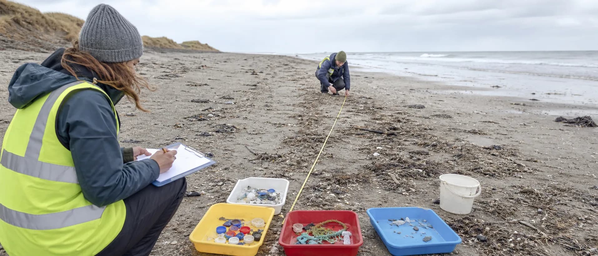
The value of a shoreline cleanup grows when the record can be compared with the next visit. A data card does not need to be complicated: fix the boundary, record conditions, tally material in consistent categories and document what was excluded. NOAA's shoreline assessment resources can help groups build a repeatable method, but the land manager's permission and safety rules still control the fieldwork.
Fix the survey segment
Choose a measurable start and finish, such as between two signs, access points or natural markers. Record whether the segment is sandy, rocky, tidal, vegetated or behind a dune. Note the date, time, tide stage if known, recent storm, wind, visitor pressure and whether the beach was open.
Walk the same width each time. Do not expand into dunes, nesting zones, private property, cliffs or the water unless the manager has approved that work. A fixed segment is more useful than a dramatic photograph of an entire beach with no defined area.
Tally material without unsafe handling
Use broad categories that volunteers can recognize: cigarette-related items, food packaging, beverage containers, foam, plastic film, fishing line, rope, fragments, glass, metal and medical or hazardous material. Count items when practical and estimate weight or bag volume separately. Keep the original category definitions with the record.
Do not open bottles, shake containers, pull embedded rope near wildlife or enter the surf for a better count. Mark sharps, ammunition, chemicals, dead animals, sealed drums and large gear as excluded. A remote shoreline may need a different response team and transport plan.
Photograph the same view
Take a fixed-view image from the legal access point with a date and direction. Include a ruler or common object only if it can be placed without disturbing habitat. Keep people, children, plates and private details out of public images. Before-and-after photos should never imply that every item on the shore was removed when the work boundary was smaller.
Publish the approved shoreline cleanup with the boundary and tide cutoff. Add the fixed-view record after removing private information, and map a recurring debris hotspot if the manager supports public reporting.
At the end, check the wrack line, access path and staging area for dropped micro-trash. Submit the data to the agreed project or agency. Consistency is the point: a modest, honest card can reveal seasonal patterns that a single heroic bag count cannot.
Sources & further reading
- Shoreline Cleanup Assessment Technique — National Oceanic and Atmospheric Administration
- Marine debris program — National Oceanic and Atmospheric Administration
Access, prices and opening times change. Verify locally before you travel.
Tags
- shoreline cleanup
- marine debris
- NOAA
- data collection
Background reading
Links to reference material and organisations we don't control.
- ReferenceBeach cleaningWikipedia
- OrganisationInternational Coastal CleanupOcean Conservancy
- VideoThe Ocean Cleanup on YouTubeYouTube
- OrganisationSurfrider Foundation — coastal protectionSurfrider Foundation