Rocky Mountain alpine lake condition reports
Record snow, ice-out, trail surface, shoreline impact and access at alpine lakes while protecting vegetation and avoiding water-quality claims.
Recently verified — 2 August 2026
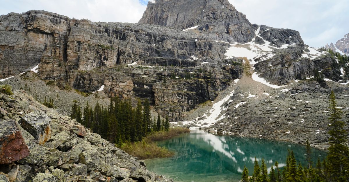
An alpine lake is linked to its entire watershed. The National Park Service monitors alpine lake systems because they are sensitive to local and landscape-scale change. A visitor condition report can add useful access information, but it is not water chemistry or ecological monitoring.
Record what you can observe without leaving durable routes, and link the managing unit's trail and permit pages.
Define the exact lake and approach
Duplicate lake names are common. Give the managing unit, official trailhead, route and observation date. Avoid publishing a precise point for an unmapped sensitive lake; the official route and broader area may be enough.
Check:
- trailhead reservation or timed-entry requirement;
- gate and parking status;
- backcountry or camping permit;
- current trail report;
- snow and avalanche information where relevant;
- weather, lightning and fire alerts;
- fishing, swimming and pet rules;
- food-storage and human-waste requirements.
Describe ice and snow as a timestamp
Use specific language: fully ice-covered from the legal viewpoint, open water at outlet, patchy shore ice, continuous snow on final mile. Do not give an “ice-out date” unless the observation series supports it.
Snow firmness changes through the day. Report time, recent weather and equipment used without recommending a crossing. Never walk onto lake ice based on appearance or another visitor's track.
Keep feet and rests off shoreline vegetation
Use established trails, rock and designated rest areas. Do not spread around the lake looking for a private lunch spot. Repeated short paths create bare ground, erosion and social trails at the most photographed shorelines.
If the official trail is muddy, follow manager guidance rather than walking through adjacent plants. Stay behind restoration ropes.
Record access conditions, not difficulty verdicts
Describe distance from the official source, elevation gain, trail surface, snow, stream crossings, exposure and route markers. “Easy” and “family-friendly” hide individual needs and current hazards.
For parking, state arrival time, lot status and legal shuttle or overflow. Do not direct readers to shoulders or private roads.
Observe impacts separately
Record toilet paper, food scraps, fire scars, fishing line, social trails and crowding. Do not dismantle structures or enter vegetation for litter. Report illegal fires and hazardous waste to rangers.
Pack out ordinary reachable debris. Map a larger alpine cleanup need from the official trail only after considering whether coordinates would expose a fragile site.
Publish the dated condition
Add an alpine lake report with snow, trail and crowding. Use the same durable viewpoint for seasonal photographs. Label water color, clarity and algae as visual observations, not diagnoses.
If camping is nearby, link only established legal sites and current permit rules. Do not promote a newly flattened shore patch.
Recheck and correct
Conditions can change within hours through storms and rapid melt. Link the official alert first and invite later dated reports. Correct a mistaken route or lake identification visibly.
The most useful alpine lake report helps the next visitor stay on the established path and understand exactly how quickly its evidence will age.
Compare photographs without manufacturing a trend
Repeat angle, time window and frame where possible, then keep the original files. Two images can show different visible ice or shore exposure; they cannot by themselves establish a climate trend or water-level cause.
Link long-term conclusions to the park's monitoring program. Use visitor photographs to document access and visible condition with dates. If a later image appears dramatically different, check lens, crop, snow cover and viewpoint before attributing change. A transparent pair is more valuable than a forced scientific claim.
Sources & further reading
- Rocky Mountain Network alpine lakes — National Park Service
- Rocky Mountain National Park trail conditions — National Park Service
Access, prices and opening times change. Verify locally before you travel.
Tags
- Rocky Mountains
- alpine lakes
- condition reports
- snow
Further reading
Links to reference material and organisations we don't control.
- ReferenceLakeWikipedia
- ReferenceProtected areasWikipedia
- VideoPBS Terra — landscapes and climateYouTube
- ReferenceThe Rocky MountainsWikipedia